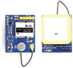
 Longitude, latitude, and altitude can be determined from the global navigation satellite system (GNSS) using radio signals transmitted by line-of-sight satellites. GNSS includes the American GPS, Russian GLONASS, European Union Galileo, Chinese BeiDou, Japanese Quasi-Zenith, and satellite-based augmentation satellite systems. The u-blox NEO-7M module used in this chapter can receive signals from the GPS and GLONASS systems.
GNSS Messages on Serial Monitor
Signal reception by the u-blox NEO-7M ...

