Prelude
Digital Modelling for Urban Design
View of the north central axis of Beijing with the Olympic Village in the foreground. Prepared by the Beijing Organizing Committee for the Games of the XXIX Olympiad and the Beijing Institute for Urban Planning.
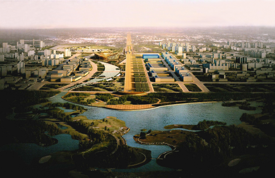
With all the comforts of a shopping mall, escalators glide visitors up to the top floor of the Beijing Planning Exhibition Hall along a huge, wall-hung cast bronze model of Old Beijing. The Ming Dynasty Imperial City was substantially intact in the model shown, which depicts the city in 1949, the year the People's Republic of China was founded. On the third floor of the museum you can walk over a giant bottom-lit satellite photograph of the present-day city - as if you could pass through your computer screen and walk on the surface of Google Earth. Physical models represent the city's Master Plan for the Olympic City south to the Forbidden City and east to the Central Business District and Chaoyang Park. The model gives visitors a taste of the modern architectural and urban design spectacle that Beijing has broadcast to the world for the 2008 Olympics. Arriving at the top floor, visitors are ushered into a small theatre, where they are given special 3-D vision glasses and strap themselves into moving seats. The lights dim and the audience begins a simulation fly-through of the city of the future. Moving seats sway during the computer-generated ...
Get Digital Modelling for Urban Design now with the O’Reilly learning platform.
O’Reilly members experience books, live events, courses curated by job role, and more from O’Reilly and nearly 200 top publishers.

