February 2021
Intermediate to advanced
176 pages
5h 1m
English
In this chapter, you will learn how drones can be used to create 3D data and geometry from photographs with a process called photogrammetry. This process is fairly simple with the technology available today, but capturing good data requires careful planning and an understanding of how the technology utilizes photographs. While the information in this chapter can be applied to many drone and camera combinations and software packages, it adheres most closely with DJI Phantom and Mavic drones and Pix4D photogrammetry software.
The photogrammetry process yields a variety of data outputs. They include:
According to Merriam-Webster, photogrammetry is “the science of making reliable measurements by the use of photographs and especially aerial photographs” (https://www.merriam-webster.com/dictionary/photogrammetry). In the photogrammetry process this chapter discusses, those measurements are used to create 3D data and geometry in the form of point clouds and meshes (Figure 9.1).
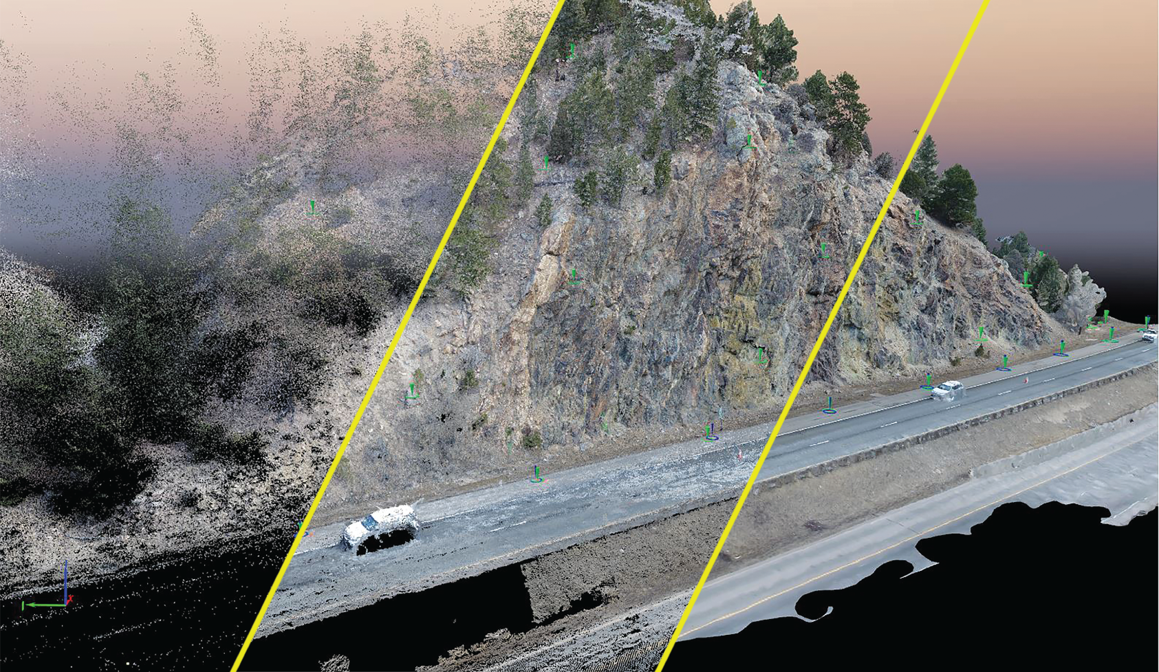
Fig. 9-1: Drone photogrammetry data along I-70 in Colorado. From left to right, initial point cloud, final point cloud, 3D mesh.
Source: Chinook Landscape Architecture and HDR, Inc.