History of geospatial analysis
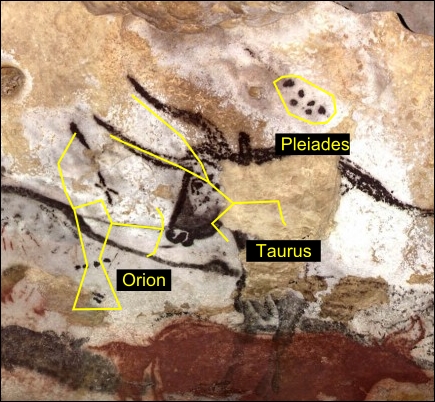
Geospatial analysis can be traced as far back as 15,000 years ago to the Lascaux cave in southwestern France. In this cave, Paleolithic artists painted commonly hunted animals and what many experts believe are astronomical star maps for either religious ceremonies or potentially even migration patterns of prey. Though crude, these paintings demonstrate an ancient example of humans creating abstract models of the world around them and correlating spatial-temporal features to find relationships. The following image shows one of the paintings with an overlay illustrating the star maps:

Over the centuries, the art of cartography ...
Get Learning Geospatial Analysis with Python - Second Edition now with the O’Reilly learning platform.
O’Reilly members experience books, live events, courses curated by job role, and more from O’Reilly and nearly 200 top publishers.

