12. Mapping Photos
In this chapter, you learn to use the mapping features available in Lightroom’s Map module.
• Changing Map Magnification and Crop
• Viewing Geotagged Image Locations
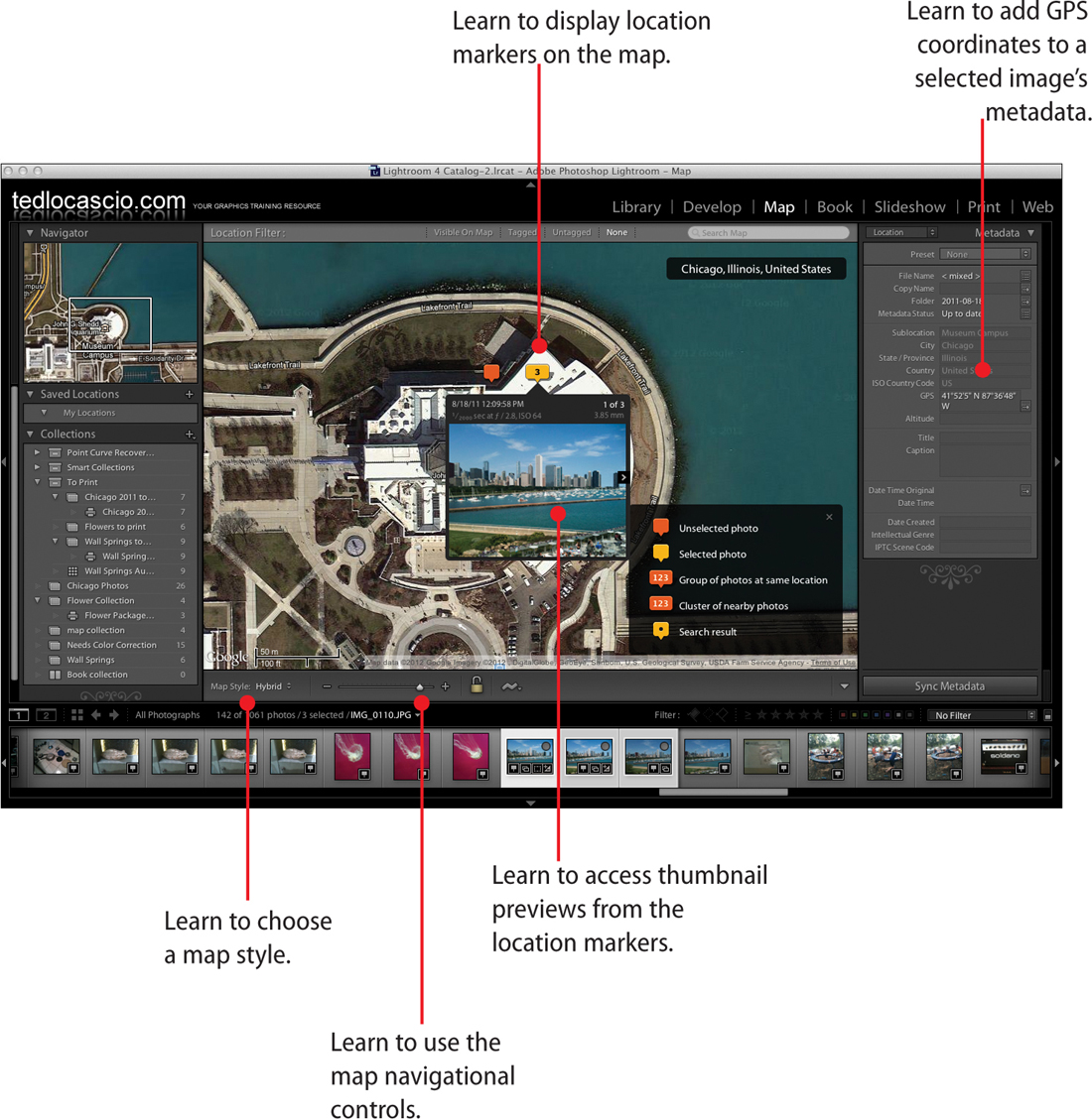
The Map module in Lightroom enables you to identify where your catalog images were captured. Any photos automatically geotagged by a digital camera contain GPS coordinates that are embedded in the image metadata. Lightroom uses this information to place markers on the map that is displayed in the Content area.
In this chapter, you learn how to display location markers for geotagged images and access thumbnail previews ...
Get My Adobe® Photoshop Lightroom® 4 now with the O’Reilly learning platform.
O’Reilly members experience books, live events, courses curated by job role, and more from O’Reilly and nearly 200 top publishers.

