Building the 3D map
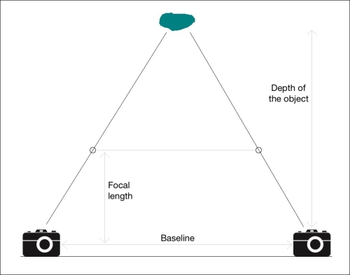
Now that we are familiar with epipolar geometry, let's see how to use it to build a 3D map based on stereo images. Let's consider the following figure:

The first step is to extract the disparity map between the two images. If you look at the figure, as we go closer to the object from the cameras along the connecting lines, the distance decreases between the points. Using this information, we can infer the distance of each point from the camera. This is called a depth map. Once we find the matching points between the two images, we can find the disparity by using epipolar lines to impose epipolar constraints.
Let's consider the ...
Get OpenCV: Computer Vision Projects with Python now with the O’Reilly learning platform.
O’Reilly members experience books, live events, courses curated by job role, and more from O’Reilly and nearly 200 top publishers.

