C H A P T E R 3
Spatial Datatypes
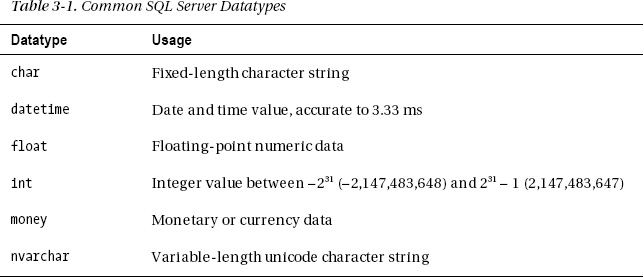
Every variable, parameter, and column in a SQL Server table is defined as being of a particular datatype. The datatype determines the range of values that can be stored and the ways in which that data can be used. You are probably already familiar with many SQL Server datatypes, such as those listed in Table 3-1.

In addition to these common datatypes designed to hold numeric, character, or date and time data, SQL Server 2012 has two datatypes specifically designed to hold spatial data: geometry and geography. These are listed in Table 3-2.
There are several similarities between the geometry and geography
Get Pro Spatial with SQL Server 2012 now with the O’Reilly learning platform.
O’Reilly members experience books, live events, courses curated by job role, and more from O’Reilly and nearly 200 top publishers.

