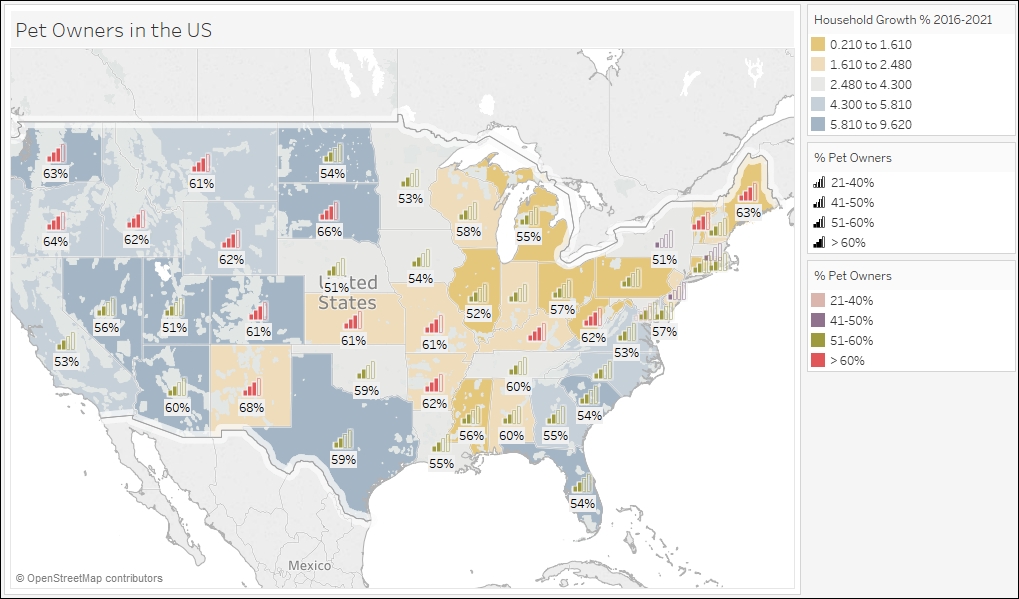
Adding data layers to map
Map layers can change the way maps look in Tableau. There are map layers that change the style of the map to use either a light, normal, or dark background. There are also data layers that overlay additional information, such as place names or population, on top of the existing map.
In this recipe, we will add coastline, state/province borders, and household growth layers to the default map that comes with Tableau:

Getting ready
To follow this recipe, open B05527_05 – STARTER.twbx. Use the worksheet called Map Data Layers, and connect to the States (catsvsdogs) data source:
How to do it...
Here are the steps to add more layers ...
Get Tableau 10 Business Intelligence Cookbook now with the O’Reilly learning platform.
O’Reilly members experience books, live events, courses curated by job role, and more from O’Reilly and nearly 200 top publishers.

