Chapter 14. Isochore and Isopach Maps
Introduction
Two key terms, isochore and isopach, are often used synonymously in the petroleum industry as measures of thickness, but they are different. An isochore map (Fig. 14-1a) delineates the true vertical thickness of a stratigraphic interval, whereas an isopach map (Fig. 14-1b) illustrates the true stratigraphic thickness of a stratigraphic interval. These two terms are often confused with respect to their geological meaning. It is vital for both exploration and development work that the correct meaning and, more important, the correct application of these two thicknesses be understood.
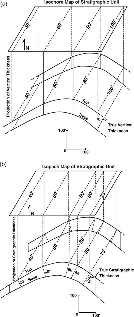
Figure ...
Get Applied Three-Dimensional Subsurface Geological Mapping: With Structural Methods, 3rd Edition now with the O’Reilly learning platform.
O’Reilly members experience books, live events, courses curated by job role, and more from O’Reilly and nearly 200 top publishers.

