June 2010
Beginner
415 pages
14h 7m
English
THERE ARE ROADS IN THE SKY. We can't see them, but they are there: distinct, sharply defined avenues, traversed by thousands of airplanes every day. As individual observers we might never guess this was the case, but plotting the raw flight data shows us otherwise (Figure 6-1).
Flight Patterns is a project I started in 2005 that visualizes civilian air traffic in the United States and Canada. It exists in two mediums: still imagery, which traces aircraft arriving and departing from U.S. and Canadian airports over a 24-hour period, and video imagery, which depicts the same data in motion. In this chapter, I'll show you some of these images and talk about the techniques I used to render them. I'll also share some thoughts on why I find this project so compelling, and why I hope you will as well.[33]
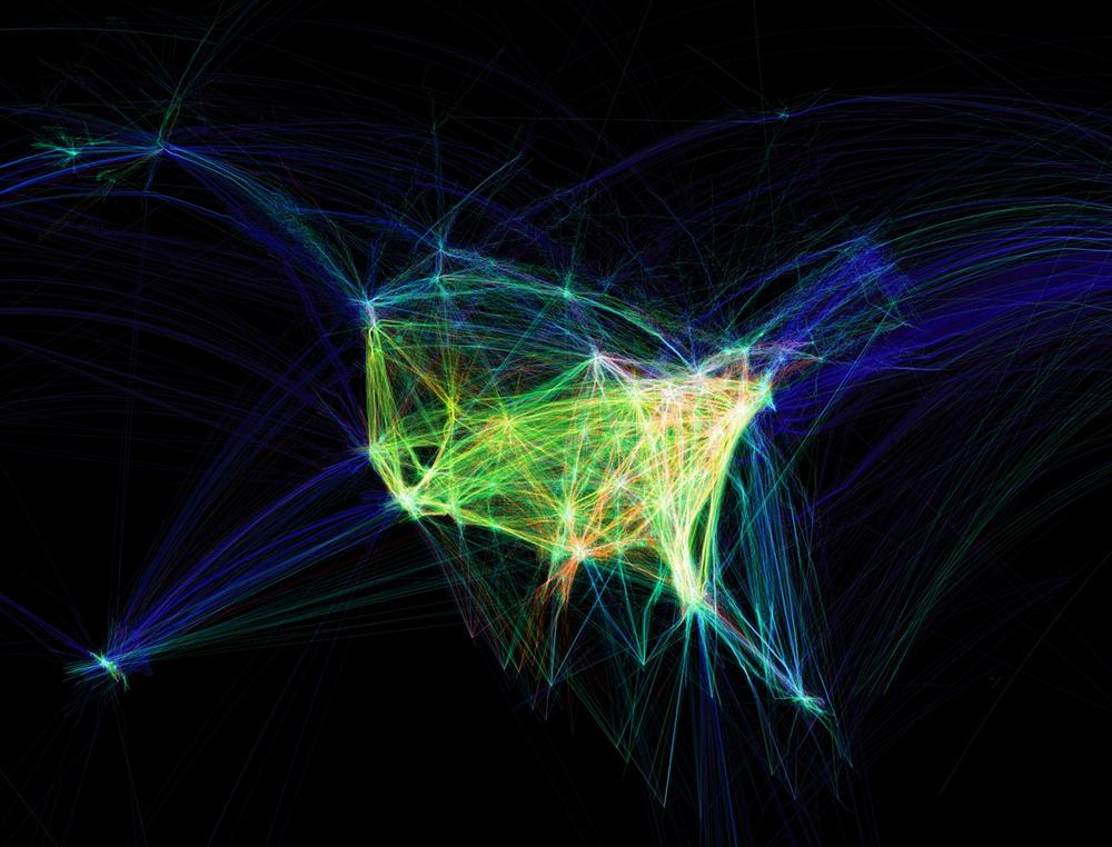
Figure 6-1. Flight Patterns, a visualization of aircraft location data for airplanes arriving at and departing from U.S. and Canadian airports
To begin with, I want to draw your attention to what I believe are the two most striking features of the visualization. The first is the tendency of airplanes to follow the exact same flight paths as other planes. When I originally rendered the data, I expected to see tight groupings of planes close to airports and a vast dispersion between them. Instead, I found the opposite: flight paths ...
Read now
Unlock full access


