11
Spatial Data and Maps
Lost in Space
We often use spatial data without realizing it. When we use spatial data within metadata applications, there are a few important considerations. In order for search mechanisms to function effectively, we need to take into account a variety of subtle issues.
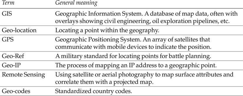
This topic is sometimes referred to as GIS, and you will find the terms listed in Table 11-1 cropping up in conversations about it. If you spare a little time to understand mapmaking theory better, you will be able to exploit that knowledge as you build your spatial metadata handling workflow.
Table 11-1 Geographic terminology
Spatial Data Structures
Get Developing Quality Metadata now with the O’Reilly learning platform.
O’Reilly members experience books, live events, courses curated by job role, and more from O’Reilly and nearly 200 top publishers.

