Fundamental Bases of Geographic Data Mode
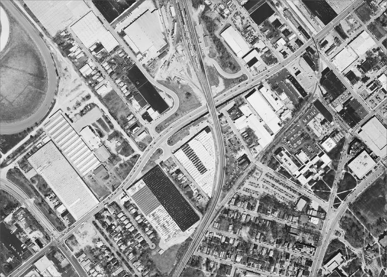
Figure 4-2 is a orthophotoquad showing a picture of a piece of Earth’s surface. It shows houses, green space, warehouses, roads, trees, railroad, parking lots, a horse race track, and so on. Suppose that you have been given the task of determining the area occupied by each of the feature types: x square feet of housing, y square feet of highway, and so on. Information about where these various land uses exist is also desired. Suppose further that the year is 1960 and you have a computer available to use for the project. If you use the computer, your employer insists that you store the information so that whatever you do can be verified by someone else.
FIGURE 4-2 An orthophotoquadrangle of part of Lexington, Kentucky
What approach would you take? Basically, to use the computer, you would have to transform the “picture” into numbers and symbols (which the computer would transform into bits). For a given theme (such as land cover) these numbers and symbols must answer two questions at the same time:
- WHAT? (entity or quantity)
- WHERE?
I don’t know how you would do this. If you think about it, you may come up with a viable, effective, and efficient scheme that no one else has thought of. If so, head for the patent office.
Here are approaches that others have come up with:
- Systematically divide the overall area up in a regular way into a ...
Get Introducing Geographic Information Systems with ArcGIS: A Workbook Approach to Learning GIS, 3rd Edition now with the O’Reilly learning platform.
O’Reilly members experience books, live events, courses curated by job role, and more from O’Reilly and nearly 200 top publishers.

