Flow Accumulation: Drainage Delineation and Rainfall Volume
Once you have a raster that indicates flow direction, a number of other interesting and useful calculations are possible. In particular, you can determine the locations of all the linear bodies of water, and you can determine, from slope and elevation, those areas where water may accumulate during times of intense precipitation. This is accomplished with the ArcToolbox Flow Accumulation tool.
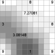
Basically, the value in each cell in the resulting raster contains the sum of the amount of water that has fallen on all the raster cells upstream from it. The intent is to simulate the flow, or potential flow, of water to form creeks, streams, and rivers. If each cell is presumed to have one unit of water (say, an inch in depth) to contribute—under a condition of “uniform rainfall,” you can think of the number in a given cell as the number of cells upstream from that cell. To illustrate, examine the elevation surface in Figure 8-25. Note that the low points are in the middle of the south edge (elevation 1) and the west edge (elevation 3). All around the rest of the raster the elevations are 9 or somewhat less.
FIGURE 8-25 Elevations of a raster
From this, you can produce a raster showing the direction of flow, using the ArcToolbox Flow Direction tool. Some arrows have been scattered on the raster to show flow direction. See Figure ...
Get Introducing Geographic Information Systems with ArcGIS: A Workbook Approach to Learning GIS, 3rd Edition now with the O’Reilly learning platform.
O’Reilly members experience books, live events, courses curated by job role, and more from O’Reilly and nearly 200 top publishers.

