Maps
When Apple brought its own Maps app to the iPhone in 2012, the underlying databases had a lot of problems. They didn’t include nearly as many points of interest (buildings, stores, landmarks) as Google. Addresses were sometimes wrong. Satellite view showed bridges and roads melting into the sea. In a remarkable apology letter, CEO Tim Cook recommended using one of Maps’ rivals.
But some of Maps’ features are pretty great—and now that Maps is a Mac app, too (Figure 19-17), there’s some handy synergy with the iPhone or iPad. You can look up an address on the Mac and then wirelessly shoot it over to the phone for navigation in the car, for example. Or simply walk over to your Mac; thanks to Handoff (Handoff), whatever map was on your phone is now on your Mac. And Maps’ smarts are wired into other OS X programs, like Calendar, Contacts, and Safari.
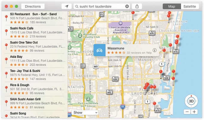
Figure 19-17. Maps lets you type in any address or point of interest and see it on a map, with turn-by-turn directions, just like a $300 windshield GPS unit. It also gives you a live national Yellow Pages business directory and real-time traffic-jam alerts. You have a choice of a street-map diagram or actual aerial photos, taken by satellite.
Meet Maps
When you open Maps, you see a blue dot that represents your current location. You can manipulate the map in all the usual ways:
Zoom in or out using the keyboard (press ⌘-plus or ⌘-minus), the ...
Get Switching to the Mac: The Missing Manual, Yosemite Edition now with the O’Reilly learning platform.
O’Reilly members experience books, live events, courses curated by job role, and more from O’Reilly and nearly 200 top publishers.

