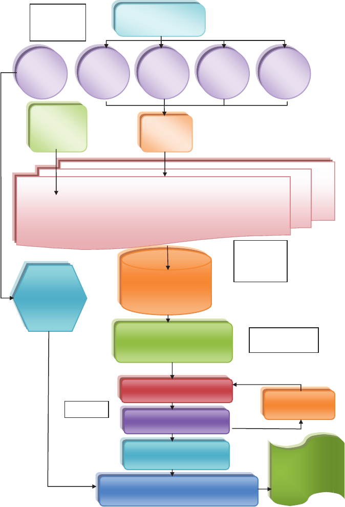
Image and ancillary data
entered into eCognition
for segmentation
1. Imagery
and data
collection
Collect imagery and
thematic data
AVHRR/
MODIS-
1 km
Landsat
30 m
SPOT,
QuickBird,
Ikonos: ½-
20 m
NAIP
1 m
Remote
control
balloon:
Sub-meter
Image pre-
processing
3. Segmentation
2. Building a
multi-scale
image base
4. Analysis
Rerun if accuracy is
inadequate
Output monitoring
reports and
analysis
Compare to previous inventories and run
change detection algorithms
Accuracy verification
Classification in eCognition
Segmentation exported to
ArcMap Sites selected for field
sampling and data collected
Annual
AVHRR/Modis
map created
to establish
greenness/
drought
trend
If accuracy is adequate,
calculate ...


