376 Fundamentals of Wearable Computers and Augmented Reality
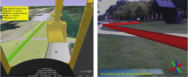
GML,inparticular, is specically created for geospatial data as an open interchange
format, and has shown to be effective in transcoding utility geodatabases for use in visu-
alization (e.g., Mendez etal. 2008). Figure 14.36 shows snapshots of experiments con-
ducted in this research using converted geodata of a DTE electrical line using Google
Earth to verify the accuracy of the geodata conversion and using an OSG-based envi-
ronment to visualize geodata in a 3D AR environment. The geodata used in these exper-
iments was processed through a series of steps to be converted to annot