134
|
Chapter 3, Mapping Your World
#28 Experiment with Different Cartographic Projections
HACK
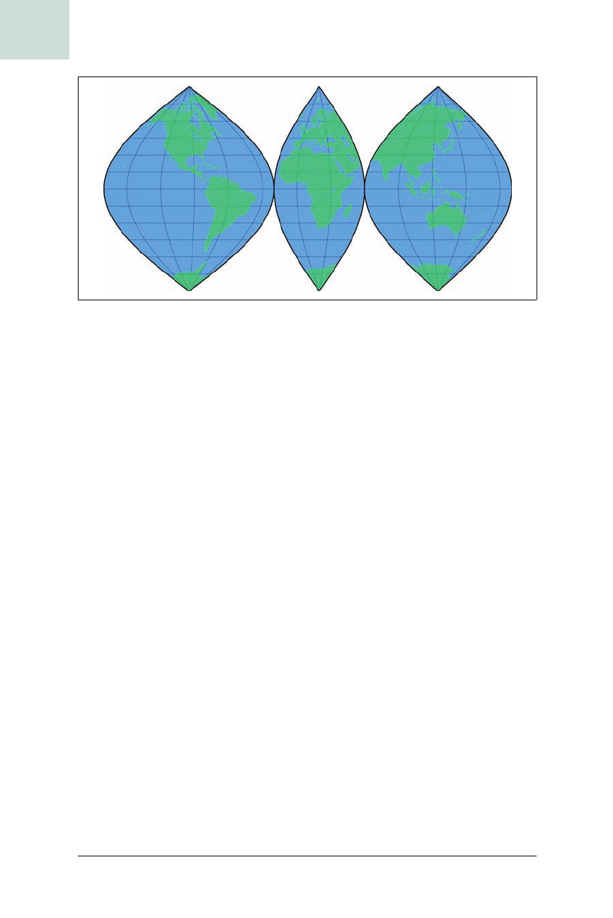
pscoast -Ji20/0.05c -R-20/60/-90/90 -Bg30/g15 -G64/255/128 -S64/128/255
-A5000 -X7.5c -O -K
pscoast -Ji125/0.05c -R60/190/-90/90 -Bg30/g15 -G64/255/128 -S64/128/255
-A5000 -X4c -O
The script was then run as follows:
$ sh ./sinusoidal.sh > sinusoidal.ps
In GMT, if a projection is specified with a lowercase letter (-Ji), rather than
an uppercase letter (
-JI), then the size measurement is taken to specify the
width of a single degree at the equator (or standard parallel), rather than the
size of the whole map. A 360-degree map of Earth at 0.05 cm per degree
would therefore yield a map 18 cm wide. We used this style of pscoast invo-
cation here because it made the value of the
-X option, which specifies how
far to offset each interrupted segment of the map along the x axis, a little
easier to calculate. (pscoast also supports a
-Y option.) Note the use of both
-K and -O to allow overlays as described earlier.
Plotting Locations with GMT
We’ve by no means exhausted either the list of possible cartographic projec-
tions or the full range of GMT’s features. GMT comes with a lot more tools
than just pscoast, but we’ll have to refer you to the documentation at http://
gmt.soest.hawaii.edu/ to learn what else it can do. We’ll just finish by high-
lighting the psxy command from GMT, which plots longitude/latitude
points ...


