Arithmetic Calculation
One of the simplest such operations involving rasters is adding them. When two rasters that represent the same geographic space and have the same cell sizes are added together, each cell of the resulting raster contains the sums of the cells in equivalent locations. In the next step, you will explore the Raster Calculator a bit more and then add the two rasters you have made.
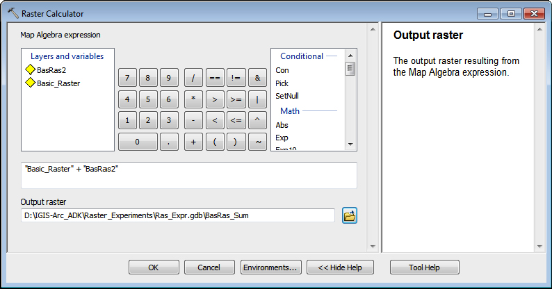
____ 14. Start the Raster Calculator again. Click Tool Help and look at the Illustration. You can come back to this if you have questions regarding the operation of the Raster Calculator. Close the help window.
____ 15. You will sum the two rasters to produce a third raster. The expression to do this is
“Basic_Raster” + “Bas_Ras_2”
You can do this in much the way you made expressions earlier: double-click the particular raster you want and single-click the operators or digits. Place this expression in the middle box. Browse and put the output in Ras_Expr.gdb, calling it Bas_Ras_Sum. See Figure 8-38. Click OK. The new raster will be added to the map. Use Identify, the T/C, the CellTool, and the Bas_Ras_Sum attribute table to convince yourself that each cell contains the correct value.2
____ 16. Use the Raster Calculator again–this time to multiply (use ∗ as the multiplication operator) Basic_Raster by Bas_Ras_2. Call the result Bas_Ras_Product—making sure, as you ...
Get Introducing Geographic Information Systems with ArcGIS: A Workbook Approach to Learning GIS, 3rd Edition now with the O’Reilly learning platform.
O’Reilly members experience books, live events, courses curated by job role, and more from O’Reilly and nearly 200 top publishers.

