Making a Personal Geodatabase Feature Class from a Coverage
What you want to do is to convert the polygon component of the Landcover coverage to a Personal Geodatabase Feature Class, so you will have all the data in the same format when you apply analysis tools to it in the future. Also, you need to fix the problem of not having the proper coordinate system associated with the land cover data. It turns out that you can do both these things at the same time, by lodging the converted feature class in a personal geodatabase data set that has the proper datum and projection. You will put it into the Area_Features feature data set that is within Wildcat_Boat_Data.mdb.
____ 19. In the ArcCatalog Tree, navigate to
___IGIS-Arc_YourInitials\Other_Data\Landcover\polygon
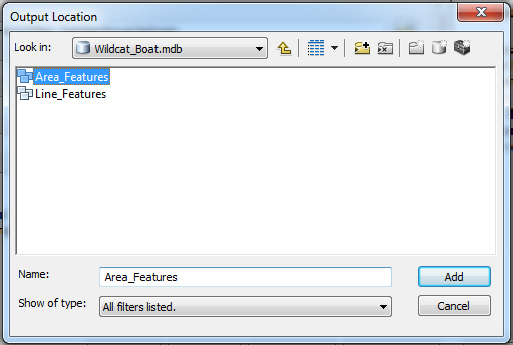
and right-click the icon. Choose Export > To Geodatabase (single). In the Feature Class To Feature Class window that appears read the Help panel on the right-hand side.37 Click in the Input Features field and read the Help panel. You will see that the text box filled in for you. Click the Browse button next to the Output Location text box, and navigate and fill in the blanks so that the window looks like Figure 1-36, making sure that Area_Features appears in the Name text box. You want the full location path to be
___IGIS-Arc_YourInitials\Wildcat_Boat_Data
\Wildcat_Boat.mdb\Area_Features
Click Add. ...

Get Introducing Geographic Information Systems with ArcGIS: A Workbook Approach to Learning GIS, 3rd Edition now with the O’Reilly learning platform.

O’Reilly members experience books, live events, courses curated by job role, and more from O’Reilly and nearly 200 top publishers.