More TIGER/Line Files
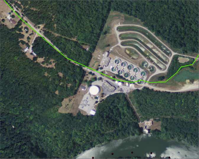
____ 27. Zoom in on the northeast corner of the DOQ, so that the water filtration plant occupies most of the window. You will notice a road that starts in the northwest of the image and traverses the area towards the east-southeast.
By using the Roads personal geodatabase feature class, contained in the Personal Geodatabase Lexington, you will be able to determine the name of that road. This feature class is somewhat different from the feature classes you saw previously, in that it does not exist within a PGDB feature dataset. Rather, it is found directly within the geodatabase. A feature class that exists directly within a database, without an intermediate feature dataset, is called “freestanding.”
____ 28. Add a layer based on the freestanding feature class Roads: Navigate to
[___]IGIS-Arc\River\Lexington.mdb\Roads
and add it to the data frame. Make it bright green, width 2. You should see a line crossing the DOQ. You will notice that it doesn’t fit the road in the image very well—which is sometimes characteristic of TIGER/Line data. That census application is less concerned with geographic accuracy than with the topology—that is, the main emphasis is on what connects to what. Try to ignore the fact that the TIGER-depicted road takes a little detour through the plant machinery. See Figure 2-28.
____ 29. Start the Identify tool. Click ...

Get Introducing Geographic Information Systems with ArcGIS: A Workbook Approach to Learning GIS, 3rd Edition now with the O’Reilly learning platform.

O’Reilly members experience books, live events, courses curated by job role, and more from O’Reilly and nearly 200 top publishers.