Selecting: Both Map Data and Attribute Data
In a geographic dataset file (cole_vctr.shp, for example), each feature in the map corresponds to a row in the attribute database. Here the features (lines) have lengths, in the unit of measurements of the shapefile (feet). Also, in this case, a description has been added to each line.
____ 25. Look at Figure 2-16 as you work this step. Make sure you are zoomed to the extent of the GPS layer (Boat_SP83). Open the attribute table of cole_vctr. Find the WHAT column. Find the attribute value Island. At the left end of that record you will see a gray box; click inside the box. The record becomes selected—shown by the fact that it is highlighted. At the same time, the line that delineates the small island at the end of the GPS track will also become selected—again shown by the fact that it is highlighted. Again, see Figure 2-16.
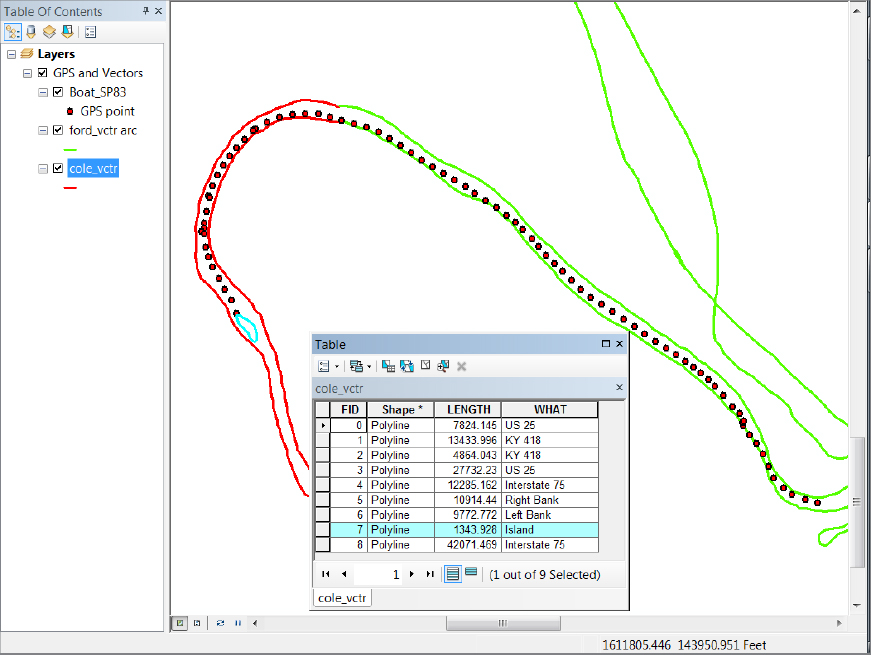
Whenever a record in a layer’s attribute table is selected, the corresponding feature in the data frame will be selected. If the layer is being displayed, the feature will be highlighted.
____ 26. Click the box of the record that has the WHAT attribute value of Right Bank. Notice that a line bounding the river is highlighted. Hold down the Ctrl key and click the box related to Left Bank. Now both records are highlighted, as are both bounding lines. At the bottom of the table, press the Show Selected ...
Get Introducing Geographic Information Systems with ArcGIS: A Workbook Approach to Learning GIS, 3rd Edition now with the O’Reilly learning platform.
O’Reilly members experience books, live events, courses curated by job role, and more from O’Reilly and nearly 200 top publishers.

