Experimenting with Different Ways of Seeing Data
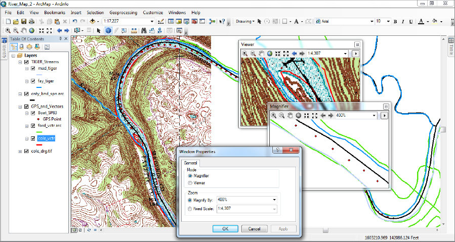
____ 15. Zoom to the GPS track using the bookmark you made previously. Click the Windows menu and click Magnifier. When the Magnifier window appears, drag it, by its title bar, so that the cross hairs are centered over the Normal Pool Elevation number and verify its value in the magnified view. _____________. Then, drag the window over the island and compare the COLE_VCTR lines with the elevation lines depicted by the topographic map. Notice that you can resize the Magnifier window by dragging its sides and corners; also you can change the level of magnification with a drop-down menu. Right-click the title bar of the Magnifier window and click Viewer to lock the view, so you can move the Magnifier window—now Viewer window—and not change its contents. Open another Magnifier window and check out its menu options by clicking the little right-pointing triangle and selecting properties from the resulting drop-down menu. Note the current properties and then experiment with them (you may have to move the properties windows if it has appeared directly on top of the magnifier window) before returning them to the original settings and dismissing the properties window. Notice that you can “see through” the Viewer window with the Magnifier window. See Figure 2-24. Dismiss the Viewer window and the Magnifier window.
____ 16. ...
Get Introducing Geographic Information Systems with ArcGIS: A Workbook Approach to Learning GIS, 3rd Edition now with the O’Reilly learning platform.
O’Reilly members experience books, live events, courses curated by job role, and more from O’Reilly and nearly 200 top publishers.

